Social leadership in the supply of raw materials for emissions free power
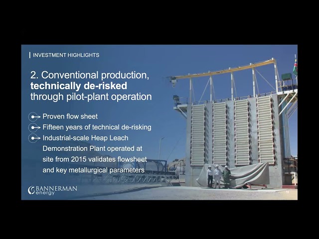
Bannerman Energy is an Australian listed uranium development company (ASX: BMN, OTCQX: BNNLF, NSX: BMN). Our flagship Etango Project is one of the world’s largest advanced uranium assets, situated in the highly established uranium mining jurisdiction of Namibia. It has been strongly de-risked through extensive drilling, technical evaluation and operation of a process demonstration plant.
Etango is now fully permitted with the Mining Licence granted and all requisite environmental approvals in place. With these key milestones achieved, Bannerman has a clearly defined pathway to development.
We are an established Environmental, Social and Governance (ESG) leader within Namibia and the global uranium sector, exercising best-practice governance in all aspects of our business.
Our world-class Etango Uranium Project is located in Namibia, an established Top 5 uranium producing country with a 40+ year history of safe export through the leading Walvis Bay terminal.
